
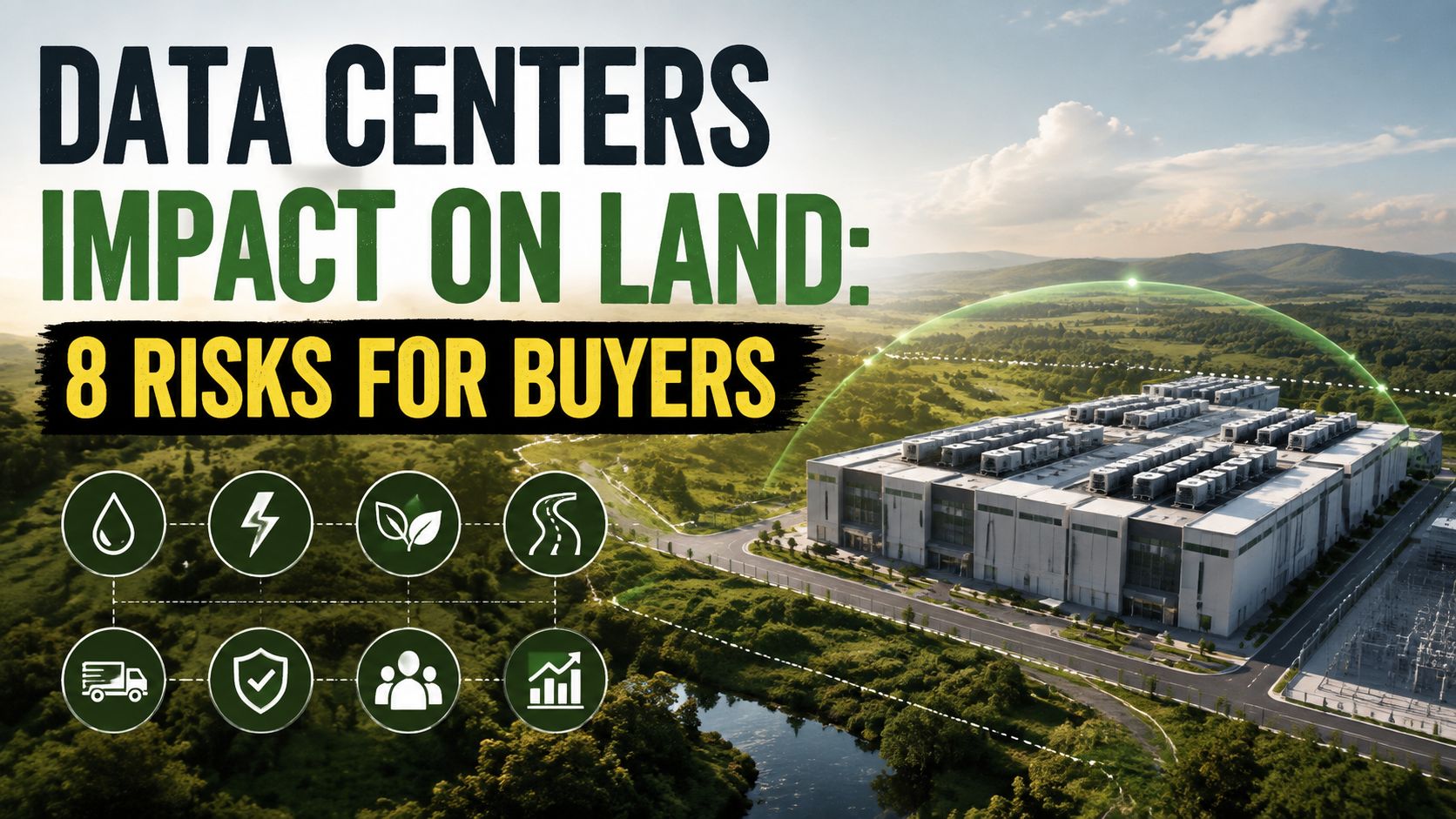
A parcel can be far from a data center and still lose some of the qualities that made it affordable, private, or useful. The reason is scale. In 2024, the average data center site covered about 224 acres, roughly 450 football fields, and that average was 144% higher than in 2022 according to industry reporting on data center land acquisition. Development also brings substations, transmission corridors, access roads, stormwater facilities, and utility easements beyond the main building.
For an affordable land buyer, this changes the due-diligence question. You're not only asking whether a parcel is cheap. You're asking what nearby infrastructure could change its water access, views, flood exposure, zoning, resale appeal, and development cost.
The eight impacts below connect data center growth to practical purchase decisions. Use state pages and budget filters to narrow options, then review LandZero financing terms, The Land Guide, zoning records, environmental databases, flood maps, utility information, and the property itself before committing. A low purchase price can help, but it doesn't remove site-specific risks.
Table of Contents
- 1. Direct Land Conversion and Habitat Loss
- 2. Urban Sprawl and Site Fragmentation
- 3. Agricultural Land Conversion and Food System Disruption
- 4. Water Resource Depletion and Watershed Degradation
- 5. Soil Contamination and Long-Term Land Remediation Requirements
- 6. Stormwater Runoff and Flooding Risk Amplification
- 7. Viewshed Degradation and Recreational Land Value Loss
- 8. Energy Infrastructure Expansion and Ecosystem Disruption
- Data Center Land Impacts: 8-Point Comparison
- Turn Environmental Risk Checks Into a Better Land Decision
1. Direct Land Conversion and Habitat Loss
Data centers can turn affordable vacant land into a long-term environmental and budget liability. Buildings are only one part of the conversion. Substations, parking, cooling equipment, security buffers, access roads, and utility connections can remove forest, grassland, wetlands, desert habitat, or agricultural ground. The World Resources Institute's review of U.S. data center growth describes the wider land footprint created by large facilities and their supporting infrastructure.
Facility size varies widely. Traditional full-scale sites may occupy around 40 acres, while the largest hyperscale campuses can exceed 1,000 acres, or about 1.6 square miles, according to TechTarget's land-use coverage. Location changes the risk. A forested parcel near a growing industrial corridor may face clearing pressure, while previously disturbed land with existing utilities may create fewer habitat conflicts.
What to inspect before buying
Check the parcel's environmental status before relying on the listing description. Look for wetlands, protected habitat, conservation easements, steep slopes, and local tree-clearing rules. A conservation restriction can protect the property while limiting a cabin, driveway, septic system, or grading plan.
- Read county records: Confirm zoning, permitted uses, overlay districts, and pending rezoning applications.
- Search environmental databases: Check mapped wetlands, protected species habitat, and regulated areas near the parcel.
- Compare disturbed sites: Previously cleared or industrial land may involve fewer habitat constraints than pristine acreage.
- Review clearing requirements: If your plan requires tree removal or grading, identify permits and disposal costs before setting a budget.
Use this practical guide to clearing your land to frame the site-work questions. Ask who controls access, whether utilities require additional clearing, and whether restrictions affect financing or resale. The best affordable purchase may be land with an established compatible use, reliable access, and fewer environmental constraints, not merely the most remote parcel.
2. Urban Sprawl and Site Fragmentation
A data center can change land beyond its fence line. Power lines, substations, fiber routes, widened roads, water connections, employee services, and security facilities may spread into surrounding rural areas. These additions can interrupt wildlife movement and reduce the privacy that attracts recreational and off-grid buyers.
Northern Virginia shows how data centers cluster around power and fiber. Similar pressure can develop in rural parts of the Midwest and Southwest. Even when your parcel is not acquired, a transmission easement next door can change access, views, noise, and future development pressure.
Practical rule: Existing infrastructure is easier to evaluate than projects that appear only on a planning map.
Trace the corridor before you buy
Review the county plan, transportation plan, utility easement records, and zoning map before making an offer. Ask whether nearby roads are scheduled for widening and whether a utility has identified a future substation or transmission route.
Use this guide to understanding property zoning in the United States to clarify zoning terms, then verify the controlling records with the county planning office. Provide the parcel number and ask about pending amendments, special-use applications, industrial expansion areas, and planned utility corridors.
Access can determine whether a low purchase price remains affordable. A parcel served by an existing public road may require less clearing and grading than one needing a long private drive across undivided land. Check recorded easements, road-maintenance obligations, and any utility rights to cross the property.
Also compare state and county rules before choosing between locations. One jurisdiction may permit clustered industrial growth near existing infrastructure, while another may route new facilities through rural areas. The difference affects your budget, financing review, resale prospects, and the amount of site work required.
A concentrated development area can reduce regional disturbance by keeping projects together. It may still conflict with priorities such as dark skies, quiet surroundings, or an uninterrupted rural view. Decide which objective matters most before filtering affordable land listings.
3. Agricultural Land Conversion and Food System Disruption
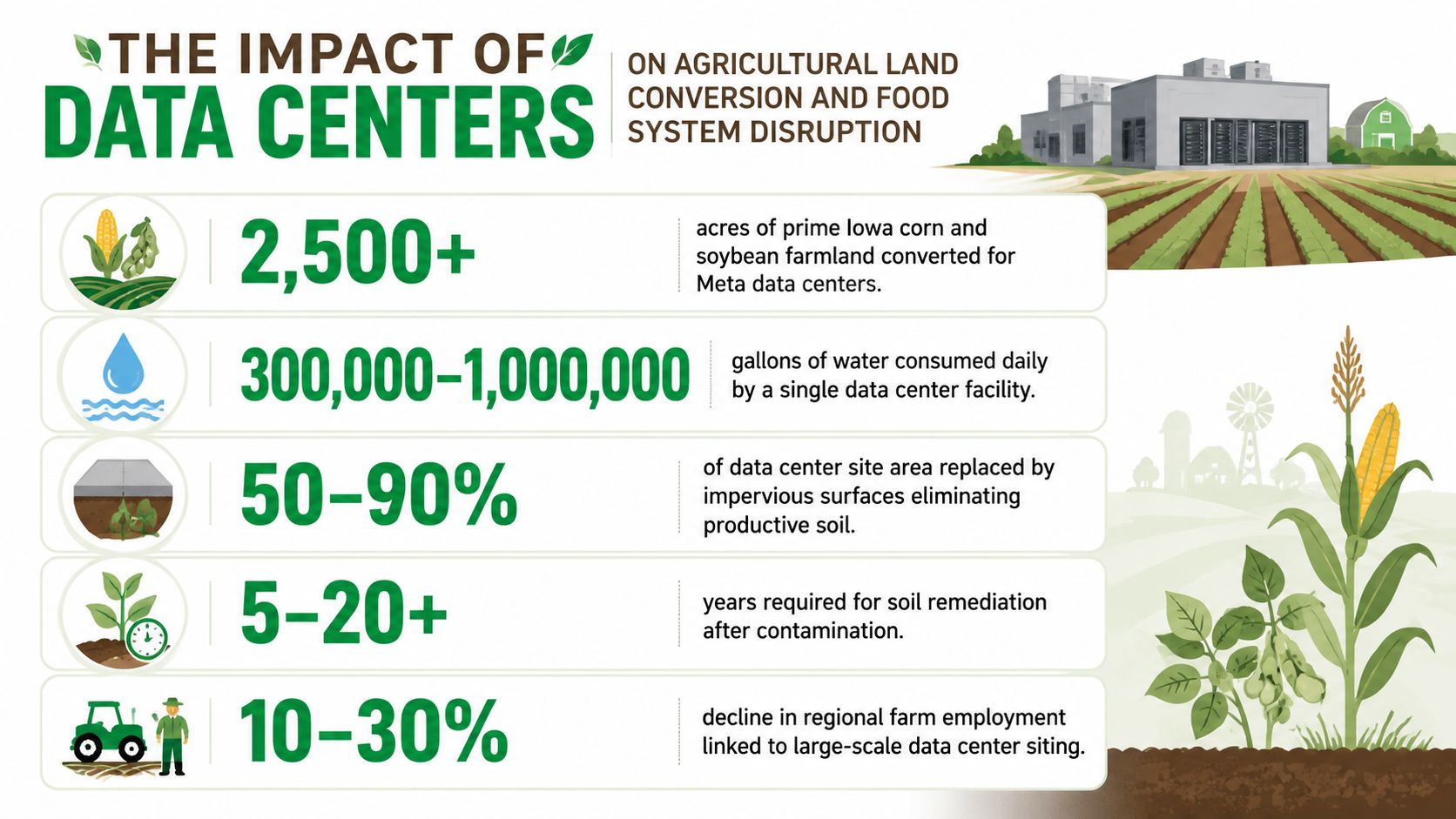
Flat, accessible farmland often attracts large industrial development because it can simplify construction and road access. That convenience creates a permanent trade-off. Once a working field becomes a campus, parking area, substation, or stormwater basin, it generally won't return to food production without major reconstruction.
The issue is especially relevant in Iowa and other agricultural regions where land carries both economic and cultural value. A buyer shopping for a small homestead may also face competition from larger projects. Recent reporting says data center demand is moving into agricultural land and can push property values higher, while market coverage from Cushman & Wakefield reports that prices for U.S. data center parcels of 50 acres or larger rose 23% year over year in 2025, from $4.39 to $5.40 per square foot.
That price signal doesn't tell you what a specific parcel is worth, but it does show why large, well-located tracts can attract powerful buyers.
Questions for farmland buyers
Review the agricultural designation before assuming you can build. County zoning may restrict residential structures, commercial activity, driveways, or subdivision. A property may also carry a preservation easement that protects farming but limits your intended use.
- Check soil classifications: USDA soil maps can show whether the tract contains prime agricultural soils.
- Confirm easements: A preservation restriction may prevent development even if the listing appears unrestricted.
- Read Right to Farm rules: Nearby agricultural operations may create noise, dust, odors, and seasonal traffic.
- Separate price from suitability: Higher surrounding values don't guarantee that your parcel has legal access, buildable ground, or a viable water source.
If your goal is a garden, grazing, or a homestead, buying land already designated for compatible residential or rural use may be more practical than trying to change agricultural zoning. If habitat preservation is your priority, avoid parcels where your purchase would encourage new conversion. Either way, ask what the land does today and what the county intends to protect tomorrow.
4. Water Resource Depletion and Watershed Degradation
Water availability can change the economics of a parcel long before a nearby project affects its sale price. Data centers use water for cooling, and the effect depends on the cooling design, water source, discharge system, climate, and local watershed conditions. The Huron River Watershed Council's discussion of data centers and watersheds emphasizes that facility water use varies substantially and that communities need information about withdrawals, discharges, stormwater, and aquatic impacts.
For land buyers in Arizona, Nevada, Utah, and New Mexico, the concern is immediate. A shallow well, limited water right, or drought-sensitive aquifer can make an otherwise attractive parcel difficult to use. In wetter regions, a project may still affect streams, wetlands, or municipal supply planning.
Verify the water system, not just the well listing
A seller's statement that a parcel has “water” can mean many things. It might refer to a well, a shared system, a legal water right, a nearby line, or nothing more than groundwater potential. Ask for well logs, permits, test results, water-right documentation, and the name of the responsible water district.
Check the state groundwater database and local drought plans. Ask whether the county has conservation mandates, pumping restrictions, or special basin rules. For an off-grid property, investigate cisterns, rainwater collection, hauled water, and storage requirements, but confirm that local law permits each option.
Water risk is a title, permitting, and infrastructure question at the same time. A map showing a nearby data center won't answer it by itself.
Also examine where industrial wastewater and stormwater go. A facility drawing from a municipal system may create different risks from one using groundwater or surface water directly. Don't assume a large employer guarantees improved local utilities. It may increase competition for capacity, raise the need for infrastructure upgrades, or influence future land-use decisions.
5. Soil Contamination and Long-Term Land Remediation Requirements
Cheap land near an industrial corridor may be cheap for a reason. Construction and utility operations can involve fuel, lubricants, coolants, transformers, batteries, and other materials. A spill may affect soil or groundwater, while older industrial uses can leave contamination that predates the data center entirely.
The practical risk is liability. Buying contaminated land can limit financing, construction, farming, residential use, and resale. Environmental restrictions may remain attached to the deed even after cleanup. A parcel beside a data center may be clean, but proximity makes a records search more important.
Build an environmental history
Begin with historical aerial imagery and prior deed records. Look for former industrial uses, storage yards, repair operations, waste disposal areas, underground tanks, and electrical equipment. Then search the state environmental agency's cleanup and contaminated-site databases.
A Phase I Environmental Site Assessment is a sensible step for industrial, commercial, or formerly used property. It reviews records and site conditions for recognized environmental concerns. If it identifies a concern, a Phase II investigation may be needed to test soil or groundwater. Don't rely on a general seller disclosure to replace professional investigation.
- Check deed restrictions: Environmental covenants can limit wells, excavation, housing, or farming.
- Locate utility equipment: Substations and transformer yards deserve closer inspection.
- Ask for closure documents: Confirm whether an agency completed cleanup and what conditions remain.
- Price the uncertainty: Testing, legal review, and remediation can exceed the original land discount.
For a remote recreational parcel, contamination may be less visible than for a building site, but that doesn't make it harmless. Avoid assuming that an empty surface means a clean subsurface. A modest due-diligence expense can prevent a much larger ownership problem.
6. Stormwater Runoff and Flooding Risk Amplification
A data center can change the flood risk of land several parcels away. Roofs, concrete, asphalt, parking areas, access roads, and equipment yards shed rain much faster than soil and vegetation. Detention basins and culverts may manage ordinary storms, yet limited capacity downstream can still produce erosion, ponding, or flooding on an affordable vacant parcel.
The buying question is simple: where will water go after the next heavy storm? An upstream campus can redirect runoff toward lower ground, a neighboring property, or a small channel that does not appear significant on a listing. Existing drainage may already be near capacity, and future construction can change conditions after you buy.
Test the drainage, not just the flood map
Start with FEMA flood maps, county floodplain layers, topographic data, and local stormwater plans. Then ask the municipal engineering department whether nearby industrial projects required detention ponds, drainage upgrades, or watershed studies. Walk the parcel after rainfall when possible. Swales, culverts, ponding, washed-out tracks, and water entering from adjacent land reveal problems that map layers can miss.
Review the evidence before choosing insurance or financing. Land outside a mapped high-risk zone may still need flood coverage if it sits below a large paved development or beside a small drainage channel. Flood exposure can also affect a lender's requirements and the cost of a future driveway, building pad, or cabin.
- Trace the outlet path: Identify where water leaves the parcel during heavy rain and whether that route crosses an easement.
- Read drainage easements: They may restrict grading, construction, or placement of a septic system.
- Budget site controls: A driveway, pad, or cabin may require swales, culverts, or other drainage work.
- Check your runoff: Permeable surfaces, rain gardens, swales, and cisterns can limit additional flow from your improvements.
A neighboring detention pond reduces uncertainty only if it works as designed. Ask who owns it, who maintains it, how blocked outlets are handled, and whether the county can enforce maintenance. Treat inspection, drainage design, and insurance quotes as land-buying costs, not optional extras.
7. Viewshed Degradation and Recreational Land Value Loss
A data center can reduce recreational land value without crossing your boundary. A buyer may accept a long drive, limited utilities, or a basic road because the parcel offers quiet, darkness, and scenery. Nearby buildings, security lighting, cooling equipment, substations, roads, and transmission structures can dominate a rural or desert horizon.
The change rarely appears in a listing. A parcel may retain legal access, buildable ground, and a working well while becoming less attractive for a cabin, campsite, astronomy, or wildlife use. Night lighting can reduce privacy and alter the experience of off-grid living.
Check the view before you buy
Search county plans and zoning maps for industrial expansion. Review pending rezoning and special-use applications, then use historical aerial imagery to see where development is moving. Satellite images cannot show every risk. Visit the parcel to assess elevation, existing lights, tree cover, road noise, and the direction of important views.
Visit after dark if dark skies influence your purchase. Inspect the horizon from likely building sites, camping areas, and access routes. Hills and forests may screen a facility now, while seasonal leaf loss exposes it later.
- Check surrounding ownership: Large vacant tracts may be more vulnerable to a future industrial sale.
- Read setback rules: Zoning setbacks may not protect a scenic corridor or preserve a clear horizon.
- Ask nearby residents: Neighbors may know about hearings or proposed projects missing from listing materials.
- Value the view: If scenery drives the purchase, include it in your land value and financing decision, not as an informal bonus.
A parcel near established infrastructure may cost less to develop, but that convenience can bring greater visual pressure. Compare the lower access and utility burden with the risk of losing privacy, dark skies, and resale appeal. Before making an offer, document current views with photographs, identify likely development parcels, and ask the county whether applications or plan changes could affect them.
8. Energy Infrastructure Expansion and Ecosystem Disruption
Power infrastructure can change a rural parcel even when the data center is miles away. Developers may require substations, generation equipment, transmission routes, access roads, and utility buffers. The Powered Land research uses a rule of thumb that every 3 to 4 megawatts of power capacity requires about 1 acre of land. It also estimates 20,000 acres of powered land for current operational data centers globally and projects another 40,000 acres over the next five years. Power planning therefore creates its own demand for land and rights-of-way.
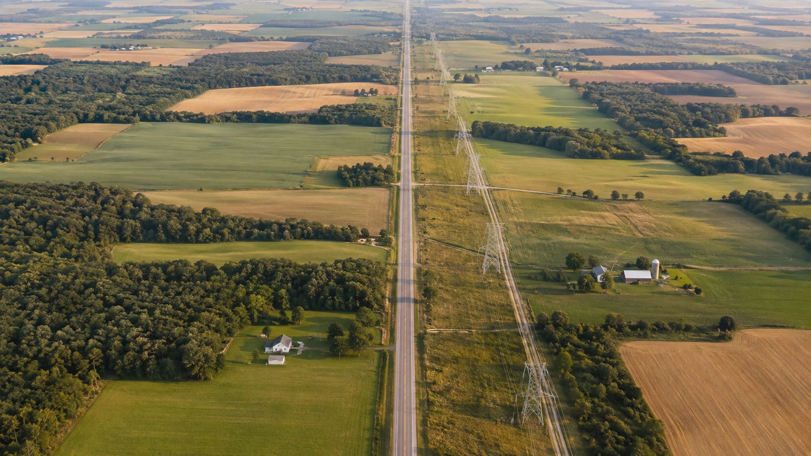
For an affordable-land buyer, the transmission corridor may matter more than the facility's distance. A line crossing the parcel can restrict construction, reduce agricultural options, or affect a proposed driveway. A nearby substation may bring noise, lighting, service traffic, and additional utility work. Compare those limits with any savings from buying near existing power infrastructure.
Map power rights before making an offer
Start with utility service maps, county planning documents, recorded easements, and public regulatory filings. Ask the local electric utility whether planned substations, generation projects, or transmission routes affect the parcel or adjoining properties. Then confirm poles, towers, underground lines, and rights-of-way through the survey and title report.
- Protect the homesite: Utility setbacks may remove the best building area, well location, or driveway route.
- Visit nearby facilities: Check sound, lighting, traffic, and air quality at substations and power plants, including during evening hours.
- Review cost exposure: A large industrial load can affect local infrastructure planning and future utility costs.
- Test backup options: Solar, wind, batteries, and generators may provide alternatives, but verify county rules, connection requirements, and installation costs.
Power availability alone does not establish value. A parcel near a transmission line may connect more easily, yet its easements can reduce usable acreage and financing appeal. Confirm who owns each line, what capacity is available, which activities the easement prohibits, and whether your intended improvements are permitted. The guide to bringing utilities to your land offers planning context, but only the utility can confirm service for the specific parcel. Save written responses in the property file before making an offer.
Data Center Land Impacts: 8-Point Comparison
| Item | 🔄 Implementation complexity | ⚡ Resource requirements | 📊 Expected outcomes | 💡 Ideal use cases | ⭐ Key advantages |
|---|---|---|---|---|---|
| Direct Land Conversion and Habitat Loss | High, large-scale clearing, grading, permanent build | High land footprint; heavy equipment; construction materials | Permanent vegetation/topsoil loss; biodiversity decline; increased runoff | Industrial-zoned or already-disturbed parcels; investors seeking development | Creates development opportunity, jobs, and higher local property values |
| Urban Sprawl and Landscape Fragmentation | Medium, phased infrastructure extensions and approvals | Linear corridors (roads, lines); utility expansion; planning coordination | Habitat fragmentation; edge effects; secondary development growth | Parcels near existing utility/road corridors; buyers wanting improved access | Improves connectivity and brings utilities closer to remote areas |
| Agricultural Land Conversion and Food System Disruption | Medium, conversion of productive fields; moderate permitting | Large contiguous acreage; irrigation and access infrastructure | Loss of farmland and seasonal jobs; reduced regional food output | Marginal or economically struggling farms; sellers seeking higher-value uses | Offers alternative income, tax revenue, and redevelopment value |
| Water Resource Depletion and Watershed Degradation | High, requires water rights, wells, and regulatory compliance | Very high water demand; pumping/treatment infrastructure; permits | Lowered aquifers; reduced streamflow; increased water conflicts | Areas with reliable regulated water or reclaimed-water systems | Can drive water-recycling tech and centralized industrial water systems |
| Soil Contamination and Long-Term Land Remediation Requirements | High, assessments, cleanup plans, long remediation timelines | Environmental consultants; remediation equipment; monitoring | Persistent soil/groundwater contamination; restricted future uses; high costs | Redevelopment specialists; buyers seeking discounted parcels with due diligence | Remediation can create jobs and restore value after cleanup |
| Stormwater Runoff and Flooding Risk Amplification | Medium, design and permit stormwater systems; possible retrofits | Impervious surfaces; retention ponds; drainage infrastructure | Increased peak runoff and downstream flooding; poorer water quality | Properties with room for detention/green infrastructure or strong municipal systems | Opportunity to implement resilient drainage and add recreational retention features |
| Viewshed Degradation and Recreational Land Value Loss | Low–Medium, erecting large visible structures and lighting | Large building footprints; lighting/security infrastructure | Reduced scenic quality; lower recreational/tourism demand; dark-sky loss | Industrial/urban edge zones; buyers prioritizing access over scenery | Can spur local employment and commercial activity in industrial areas |
| Energy Infrastructure Expansion and Ecosystem Disruption | High, grid upgrades, new plants/substations, long lead times | Significant land for lines/plants; fuel/mining; substations | Habitat fragmentation from corridors; increased emissions if fossil; EMF exposure | Parcels near existing transmission or with renewable potential | Drives grid modernization, renewable investment, and skilled jobs |
Turn Environmental Risk Checks Into a Better Land Decision
The best response to data center growth isn't automatically avoiding every developed region. Some buyers want rural isolation and scenic protection. Others prefer an already disturbed parcel near roads, utilities, and services because those conditions can reduce development difficulty. The right choice depends on your intended use, risk tolerance, water needs, and budget.
Start by choosing a state and budget tier, then define what the parcel must do. A recreational buyer may prioritize views, quiet, and dark skies. A homesteader may need reliable water, usable soil, access, and septic suitability. An investor may focus on zoning, title, resale demand, and infrastructure. Don't let a low monthly payment substitute for a clear use case.
Use a consistent screening sequence
- Set the geographic and financial limits: Compare LandZero listings by state and budget, including collections such as Land Under $5k, $5k to $10k, and $10k & Up. Treat the listing price as the starting point, not the total project cost.
- Confirm intended use: Decide whether you need camping, a cabin, agriculture, storage, recreation, or future construction. County rules may allow ownership but restrict the use you have in mind.
- Review zoning and environmental restrictions: Check the county zoning map, plan, wetlands, floodplain, conservation easements, protected habitat, and agricultural designations.
- Verify water conditions: Confirm wells, water rights, district service, groundwater conditions, drought rules, and lawful alternatives such as cisterns or hauled water.
- Inspect flood and drainage exposure: Review FEMA maps and local data, then visit the property and ask how nearby development manages runoff.
- Trace infrastructure: Search utility easements, transmission corridors, planned substations, road projects, fiber routes, and industrial rezoning.
- Investigate prior land use: Order an appropriate environmental assessment when the parcel or its surroundings have industrial, commercial, storage, mining, or waste-related history.
- Confirm access and development costs: Verify legal access, road condition, survey boundaries, driveway requirements, septic feasibility, utility connection costs, and any required permits.
Use The Land Guide library and the LandZero FAQ to build your research list, but verify important facts with county offices, utilities, surveyors, environmental professionals, and water authorities. Remote online purchasing is convenient, yet no website can inspect every drainage ditch, easement, title exception, or future zoning decision for you.
LandZero's FlexPay owner financing can address financing barriers through zero down payments, no credit checks, zero closing costs, and monthly payment plans, but those terms don't prove that a parcel is buildable, watered, accessible, or protected from nearby development. Review the contract, calculate taxes and site costs, and complete property-specific due diligence before purchasing. Financing can make ownership easier to start. It can't make unsuitable land suitable.
LandZero offers vacant land listings organized by state and budget, with online purchasing and FlexPay owner financing for buyers who need a lower-friction path to ownership. Visit LandZero to compare parcels, then use the available guides and property records to screen each one for data center growth, infrastructure easements, water, flood, zoning, and environmental risks before you commit.