

A U.S. residential boundary survey averages about $1,330, with a reported range of $1,010–$1,650, but your actual quote depends more on the scope and difficulty of the work than acreage alone. Treat that benchmark as a starting point, not a price promise for the parcel you're considering.
You've found vacant land that seems affordable, and you're checking what it will take to buy it. Then someone asks whether the boundaries have been surveyed, and an expense you hadn't budgeted for becomes part of the decision. Before accepting or rejecting the quote, you need to know what the surveyor is being asked to establish and what you'll receive.
Table of Contents
- What Land Survey Costs Mean for Buyers
- How Surveyors Build the Final Price
- Choose the Right Survey Scope
- See What Changes a Survey Quote
- Sample Land Survey Cost Scenarios
- Compare Quotes and Control Survey Expenses
- Plan Survey Spending Before Closing
What Land Survey Costs Mean for Buyers
Consider a first-time buyer preparing to purchase a recreational parcel. The listing includes a map, the seller points out an apparent corner, and a fence follows part of the property. When the buyer asks for confirmation of the boundaries before closing, the survey estimate feels like an unexpected addition to an otherwise inexpensive purchase.
The buyer's useful question isn't whether the land is cheap enough to justify surveying. It's what uncertainty needs to be resolved before committing to it. A low purchase price doesn't make unclear boundaries easier to reconstruct.
The national benchmark comes from ProMatcher's residential boundary survey cost dataset. That dataset also reports an average principal-surveyor rate of $116.07 per hour and approximately $4.32 per linear foot of perimeter, but those measures describe different ways of expressing cost, not interchangeable quotes for your property.
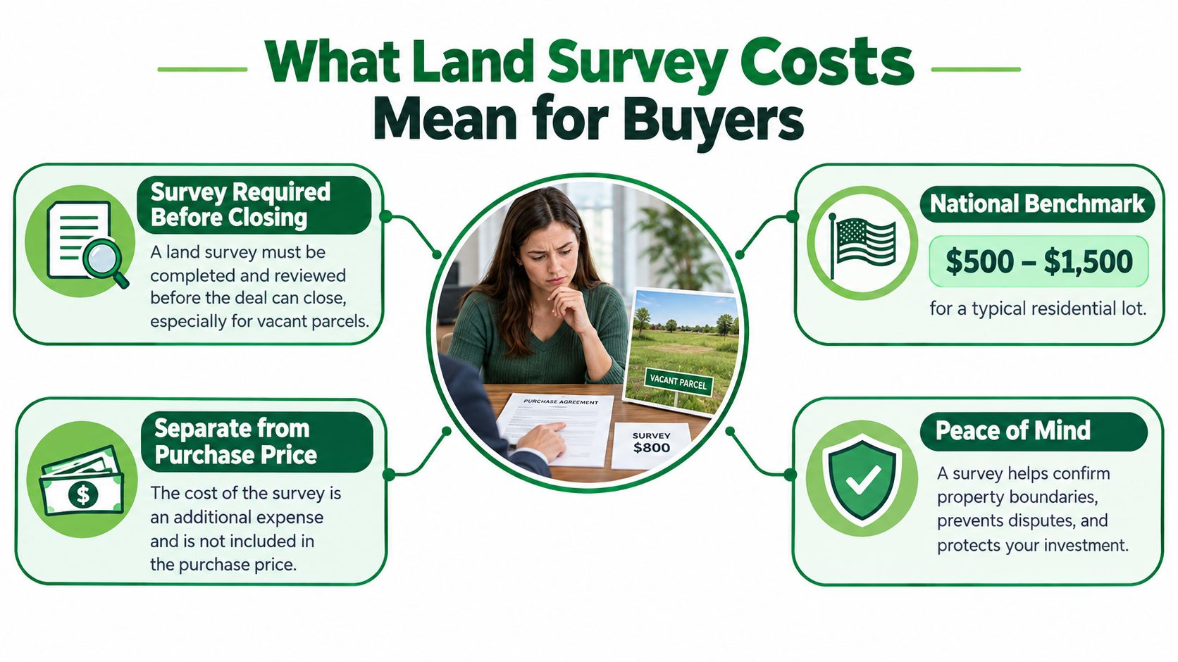
A map location isn't a boundary opinion
Think of a map pin as an address on an invitation. It helps you find the destination, but it doesn't establish precisely where the property begins and ends. A location sketch may offer useful orientation, while a boundary survey involves records, measurements, boundary evidence, and professional judgment.
That distinction matters when you compare prices. A quote for showing an approximate location shouldn't be evaluated as though it includes a signed boundary plat, recovered corners, and whatever certification your transaction requires.
Practical rule: Describe the decision you need to make before asking a surveyor to price the work.
For example, tell the surveyor that you need to understand the parcel's boundaries before purchasing, rather than asking for the cheapest survey. Then explain whether anyone else must accept the finished document.
Useful opening questions include:
- Purpose: Are you confirming boundaries, preparing for construction, or satisfying a transaction requirement?
- Recipient: Will a lender, title company, county, or designer use the survey?
- Deliverable: Do you need marked corners, a signed plat, digital files, or a defined combination?
You're buying an answer supported by evidence, not merely a measurement of acreage.
How Surveyors Build the Final Price
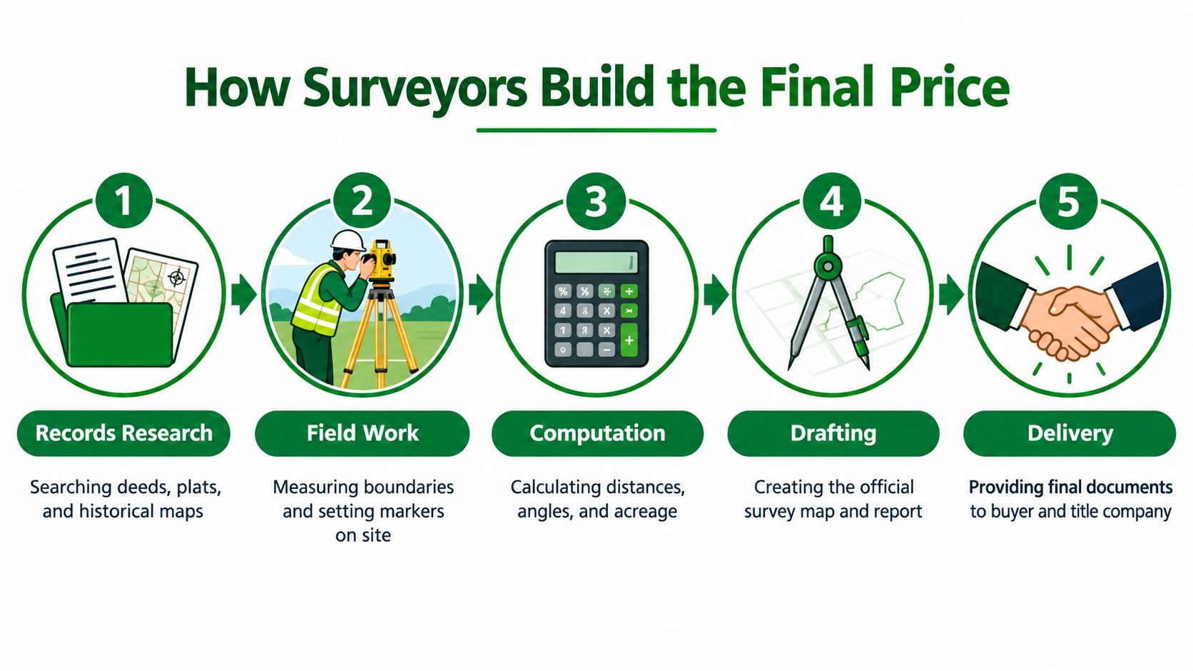
Survey work can begin before anyone arrives with a tripod. The firm may need to review deeds, prior plats, adjoining descriptions, and other records to understand what evidence the field crew should look for. After the site visit, staff still need to process observations, evaluate the evidence, and prepare the agreed documents.
Fieldwork is only part of the invoice. A crew leaving the property doesn't mean the professional analysis is finished.
Who does the work
Surveying firms use different combinations of licensed professionals and technical staff. Technicians can assist with instruments, observations, records research, data processing, and drafting; the licensed surveyor provides professional judgment and certification where required.
The Bureau of Labor Statistics surveyor wage benchmark reports median pay of $75,440 annually, or $36.27 per hour, in May 2025. For surveying and mapping technicians, BLS reports median pay of $54,240 annually, or $26.08 per hour, in May 2025.
Those are employee wages, not customer billing rates. The business also has to cover equipment, vehicles, software, insurance, licensing, administrative work, travel, and profit. Comparing a professional quote directly with an employee's hourly wage leaves out much of the cost of providing the service.
What an itemized estimate should explain
A useful estimate connects the total to identifiable activities. Ask the firm to distinguish the work it expects to perform from work that might become necessary later.
| Quote component | What you want clarified |
|---|---|
| Records research | Which existing documents will be reviewed? |
| Travel and fieldwork | Are mobilization and site visits included? |
| Monument work | Does the fee cover recovery, replacement, or both? |
| Computation and drafting | What analysis and mapping are included? |
| Delivery | Which certifications, files, and filing services are provided? |
Not every firm will price each activity separately. A fixed-fee proposal can still be clear if it describes the included work and its assumptions.
For instance, a narrowly defined location task may require less investigation and produce fewer deliverables than a certified boundary retracement. The lower price may accurately reflect the smaller assignment. Your job is to check whether that smaller assignment answers your question, rather than assume that either the lowest or highest total represents better value.
Choose the Right Survey Scope
Suppose you're considering vacant land for a future home. Before buying, your concern may be where the property lines lie. Before designing a driveway, you may need elevation information, and a development lender may later require a different package of title-related survey information.
Those are related decisions, but they aren't the same assignment. Choose the survey around the immediate risk and the requirements of the people who will use it.
Survey Scope by Buyer Need
| Survey Scope | Primary Purpose | Key Deliverables | Best Fit |
|---|---|---|---|
| Boundary survey | Establish or retrace property lines | Boundary evidence and measurements, with monument work and a signed plat as specified | Buyers seeking boundary certainty |
| Topographic survey | Describe elevation and terrain | Elevation information and mapped features within the agreed scope | Grading, driveway, and site-design planning |
| ALTA/NSPS land title survey | Provide a standardized title-related survey product | Required fieldwork, mapping, certification, and selected optional items | Transactions with specified lender or title-insurer requirements |
A boundary survey can be sufficient when your concern is the parcel's limits and the intended recipient accepts that scope. It shouldn't be treated as an automatic substitute for terrain information needed by a designer.
A topographic survey addresses the shape of the ground. If your question concerns a sloping building area or a driveway route, ask the designer what elevation information they need before requesting a proposal. Don't assume that purchasing boundary work automatically purchases topography.
When ALTA/NSPS requirements matter
An ALTA/NSPS land title survey follows a more extensive standardized framework. The 2026 ALTA/NSPS standards, effective February 23, 2026, distinguish required work from optional Table A items that can expand the assignment.
Depending on the selected requirements, the scope may address improvements, utilities, access features, easements, or flood-related information. Ask the lender or title insurer to identify the required selections rather than requesting every available option.
The broadest survey isn't automatically the most useful survey. The useful survey answers the purchase or planning question and meets the recipient's requirements.
Before requesting proposals, gather the parcel's deed description and any existing plats. Understanding legal land descriptions can help you explain which tract you're asking the surveyor to evaluate, particularly when a listing map isn't enough.
Avoid both extremes: ordering an expansive title survey without a reason, or buying a basic sketch when the transaction requires certified boundary evidence. Written scope confirmation is more useful than guessing from the service name.
See What Changes a Survey Quote
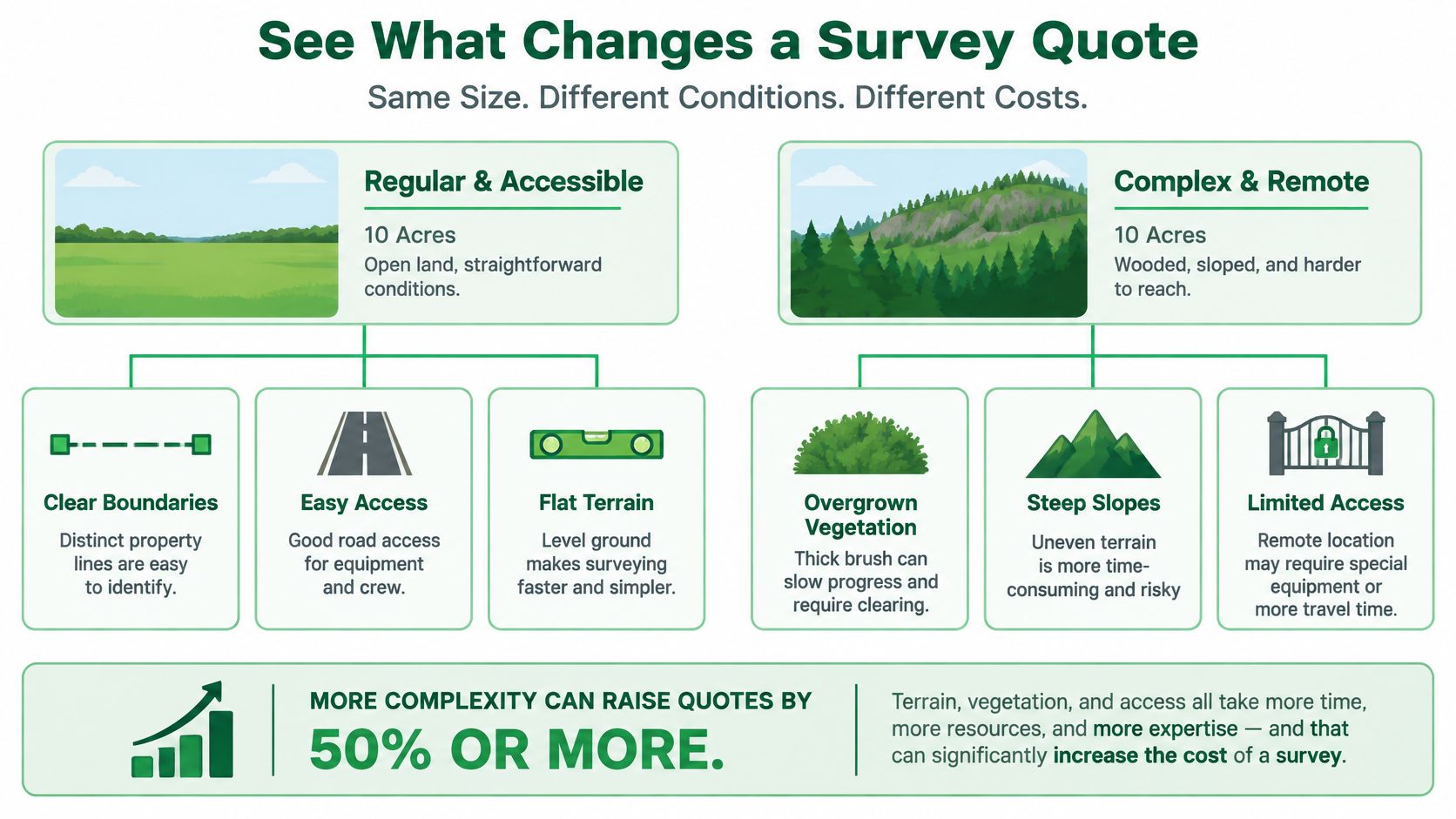
Equal acreage doesn't mean equal effort. Compare an accessible, regularly shaped parcel with a narrow, wooded tract reached through difficult terrain. Even if their areas match, the second property may require more travel, harder fieldwork, and more boundary investigation.
Perimeter can be more informative than acreage because the crew must investigate the parcel's boundary configuration. Even then, a linear-foot estimate won't explain the whole assignment if the records are inconsistent or the corners can't readily be found.
Site conditions and evidence conditions
The remote-land survey cost discussion from How to Buy Plots identifies travel, terrain, vegetation, access, monuments, and records as important pricing considerations. For a buyer, it helps to separate physical difficulty from evidence difficulty.
- Terrain and vegetation: Slopes and dense growth can make reaching and observing boundary evidence harder.
- Travel and access: A remote location, locked gate, or uncertain route should be disclosed before the firm estimates its visits.
- Parcel geometry: Narrow, irregular, or fragmented boundaries may involve more work than a compact shape.
- Monuments and records: Missing markers, poor descriptions, and conflicting documents can require additional investigation.
- Disagreement: Tell the surveyor about a known boundary dispute rather than allowing the proposal to assume an uncomplicated retracement.
A parcel can be physically easy to walk yet difficult to research. Another can have clear records but challenging ground conditions. Ask the surveyor which kind of uncertainty affects your quote.
Identify assumptions before they become extra work
Request an explanation of what happens if the crew finds conditions different from those described. Does the estimate assume that existing monuments are recoverable? Does it include investigating a conflicting description, or would the firm request authorization for additional work?
If you're considering dividing the property, disclose that purpose too. Reviewing what subdivision involves can help you recognize when your intended project extends beyond confirming an existing boundary.
Don't treat any general complexity allowance as a substitute for a parcel-specific proposal. Ask for a written description of the conditions that could change the price, and how the firm will notify you before proceeding.
Also distinguish physical access for the crew from legal access for the property. A route that allows someone to reach the site doesn't, by itself, answer your legal-access question.
Sample Land Survey Cost Scenarios
Use the following situations as budgeting illustrations, not local offers or completed case studies. Published benchmarks place small residential boundary surveys under 0.5 acre around $300–$900, while larger or more complex assignments, including ALTA work, topographic mapping, and difficult terrain, can reach $2,000–$5,000 or more, as summarized with the ALTA survey scope and cost reference.
The important distinction is what moves a parcel into a more demanding assignment. Don't assign your property to a range solely because its acreage looks similar.
An accessible residential-scale parcel
Consider a small lot with available records and straightforward access. The lower-cost published category may be a reasonable starting point for requesting estimates, but you still need to specify whether the work includes corner marking, a signed plat, and the certification required for your purchase.
A credible proposal explains those deliverables and identifies assumptions about existing boundary evidence. Without that detail, you can't tell whether an apparently affordable price covers your intended use.
A remote parcel with uncertain evidence
For an isolated tract, begin with the uncertainty rather than choosing a price band. Tell the firm what you know about access, vegetation, prior surveys, and any missing markers.
The surveyor may need to assess the records before confidently pricing the fieldwork. Ask whether the proposal is fixed, time-based, or subject to defined additional work. A larger reserve may be sensible, but the published complex-work range isn't a ceiling for every remote parcel.
A parcel needing design or title-related work
If you're planning development, ask the designer and transaction participants to identify their needs before requesting an expanded survey. Elevation mapping and specified ALTA requirements should be priced as actual scope, not added because a more expensive product sounds safer.
For an out-of-state buyer, the final documents also deserve attention. Ask how you'll receive them and whether the surveyor can explain what was established and what remains outside the assignment.
Budgeting caution: A published range can help you prepare to request quotes. Only a parcel-specific written proposal tells you what your money will purchase.
Keep the survey reserve separate from the land price. If the necessary work would strain your budget, resolve that issue before committing rather than relying on the assumption that a bargain parcel must be inexpensive to investigate.
Compare Quotes and Control Survey Expenses
The cheapest proposal is only comparable with another proposal when they promise substantially the same work. A short scope description can conceal important differences without either firm having made an error.
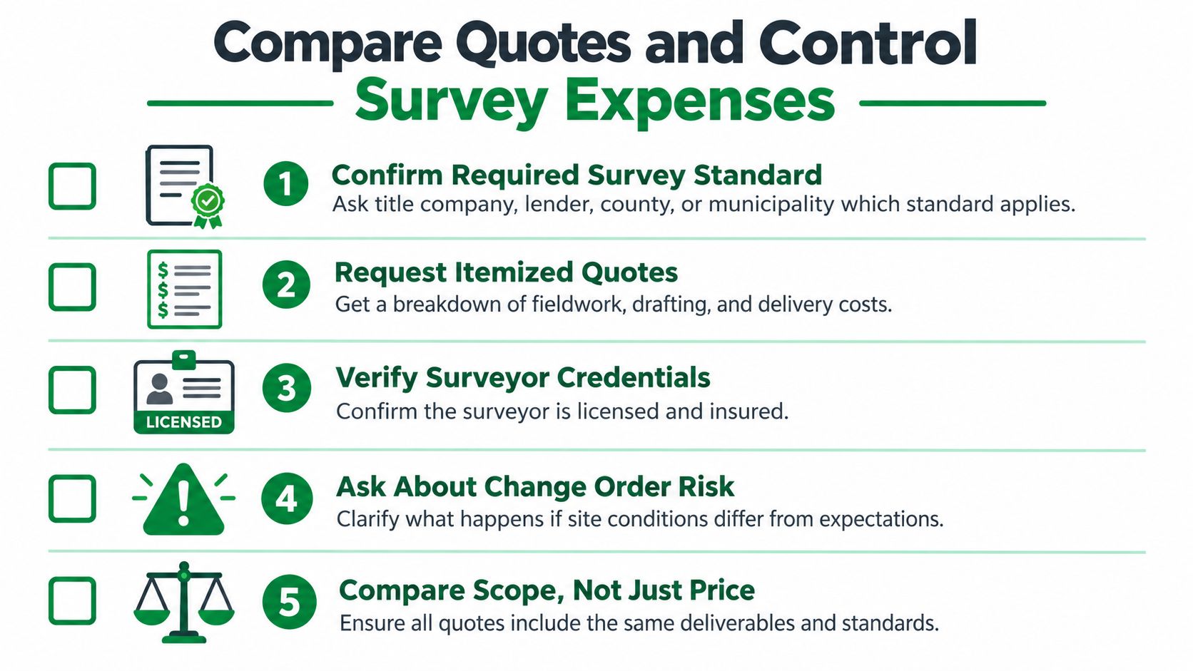
Start by asking the title company, lender, county, or permitting authority what they need to receive. Then send that requirement to each surveyor with the same parcel information and intended use.
Normalize the proposals
Create a comparison sheet before deciding. If a proposal doesn't address an item, mark it as unconfirmed, not included.
- Research: Identify the records review and title-related information covered.
- Fieldwork: Clarify travel, site visits, and assumptions about access.
- Monuments: Distinguish finding existing markers from replacing or establishing them.
- Finished documents: Confirm the signed plat, certifications, digital files, and any filing work.
- Price basis: Ask whether the amount is fixed or depends on time and materials.
- Additional authorization: Establish how unexpected work will be approved and billed.
Verify that the professional is appropriately licensed for the property's state, and ask about insurance. Discuss who will answer questions about the finished survey, especially if you won't be able to meet the crew onsite.
Reduce avoidable work, not necessary evidence
Give the surveyor useful documents at the outset: the deed description, existing surveys, available plats, and relevant transaction requirements. Let the professional determine whether those materials can be relied upon. An old survey can be helpful background without automatically satisfying the current assignment.
Ask whether related needs can be scoped together. If your designer already expects elevation information, disclosing that early allows the firm to propose coordinated work instead of discovering the requirement after delivery.
Don't move markers or undertake clearing based on your own interpretation of a boundary. Ask the surveyor what preparation, if any, would be appropriate and whether permission is needed.
A sensible way to control land survey costs is to remove ambiguity from the assignment. Avoid an unnecessary ALTA upgrade, but don't delete essential boundary investigation merely to reach a preferred total.
Finally, agree on a delivery expectation and discuss what happens if a problem is discovered. You need enough room in your purchase decision to understand the findings, ask questions, and consult other professionals where necessary, not just receive a document before a deadline.
Plan Survey Spending Before Closing
A sound survey budget begins with a clear statement of risk. Write down what you need to know, who must accept the answer, and which document or field marking will make the result usable.
If your immediate concern is boundary uncertainty, obtain a proposal directed at that concern. If you're preparing a grading plan or meeting development-financing requirements, have the relevant professional specify the additional information needed.
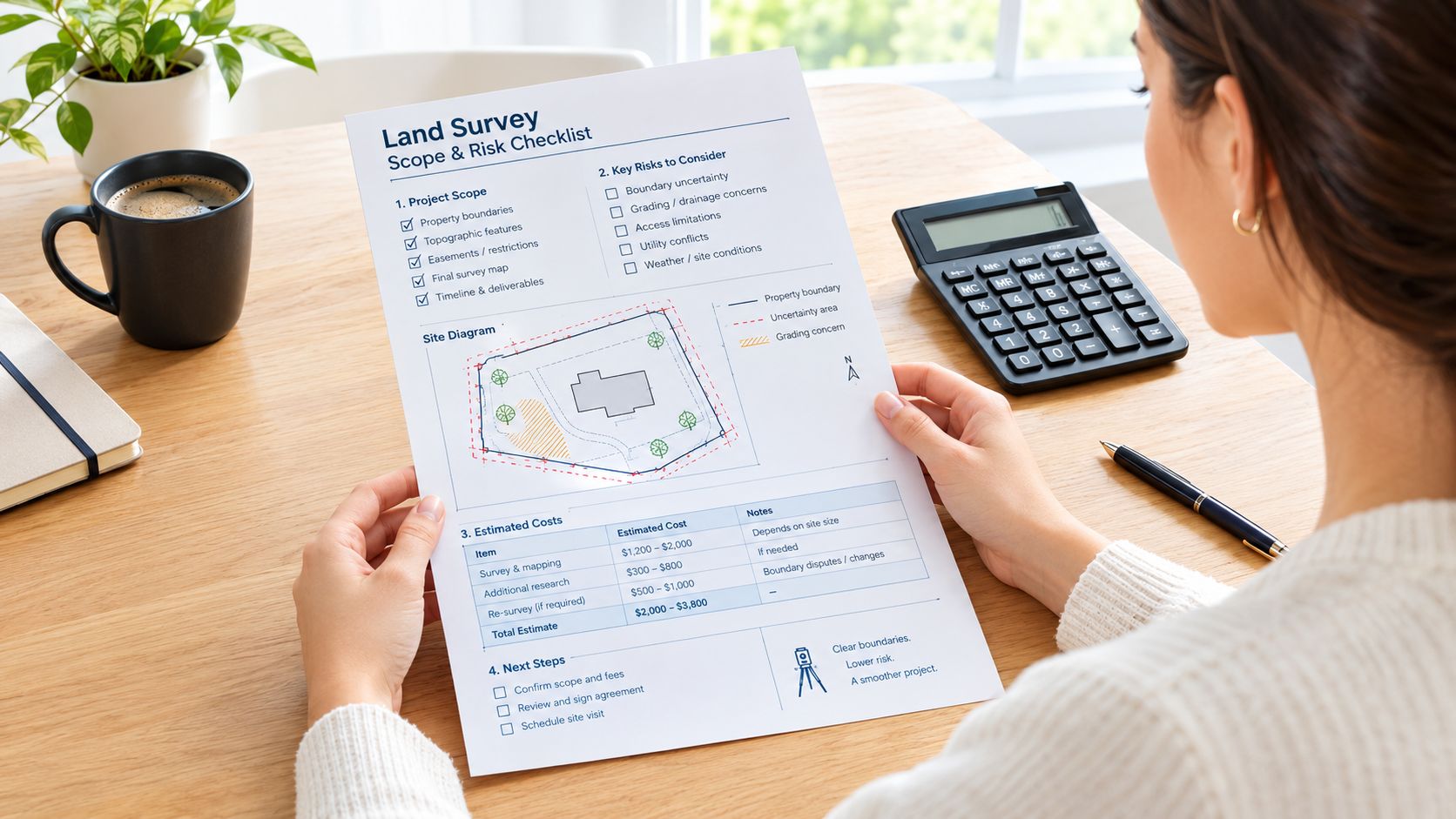
Keep purchase readiness separate from survey readiness
An affordable payment arrangement doesn't answer whether the parcel has been surveyed for your intended use. Likewise, a simple online purchase process doesn't replace your review of the property's records, conditions, and restrictions.
Use a land survey requirements checklist to prepare questions before purchase. Confirm the actual requirements with the parties involved rather than assuming every vacant-land transaction needs the same survey.
Keep separate questions on a separate due-diligence list:
- Legal access: What rights allow you to reach the parcel?
- Zoning and permitted use: Can you pursue your intended activity?
- Septic feasibility: What evaluation and approval would be required?
- Utilities: What service is available, and what further investigation is needed?
- Buildability: Which site and permitting questions remain unresolved?
A survey may provide information relevant to those issues without resolving all of them. Ask explicitly what falls outside the engagement so you don't mistake a completed survey for complete property due diligence.
Before committing, obtain matching written quotes, reserve the necessary funds, and decide how you'll respond if the findings affect your plans. For a budget-conscious buyer, that preparation is more useful than searching for a national price that appears to fit.
The cheapest survey isn't necessarily the least expensive decision. Pay for the deliverable that addresses your actual risk, and avoid purchasing unrelated work just because it sounds more thorough.
Visit LandZero to compare vacant-land listings across multiple states and review FlexPay owner financing, including zero-down financed purchases, no credit checks, and zero closing costs. As you narrow your choices, request the available parcel records and obtain a survey quote matched to your intended use so your purchase budget includes the due diligence you need.