
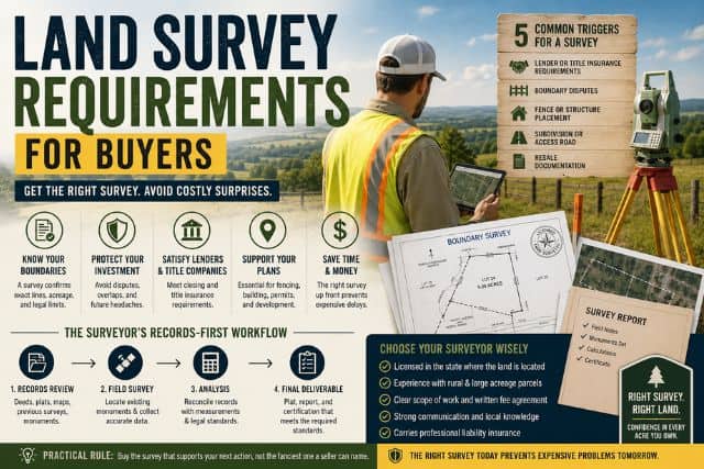
Land survey requirements are not a single federal rule, and a survey for closing can differ sharply from one for title insurance, a fence, or a build permit. The standard you need depends on the use case, and the deliverable changes with it, so a cheap survey can still be the wrong survey if it doesn't match the job.
You're usually learning this the hard way, halfway through a purchase, with a seller, lender, title company, or county office asking for something you didn't expect. That's where first-time buyers get burned. They either order too little, too late, or they pay for a fancy plan when all they needed was a clean boundary document that fits the transaction.
Table of Contents
- What Land Survey Requirements Actually Mean for a Buyer
- When You Actually Need a Survey and When You Don't
- The Records-First Workflow a Licensed Surveyor Runs
- How State-Specific Standards Change the Deliverable
- Choosing the Right Licensed Surveyor for Your Parcel
- A Realistic Timeline and the Documents You Should Expect
- Final Checklist Before and After the Surveyor Leaves
What Land Survey Requirements Actually Mean for a Buyer
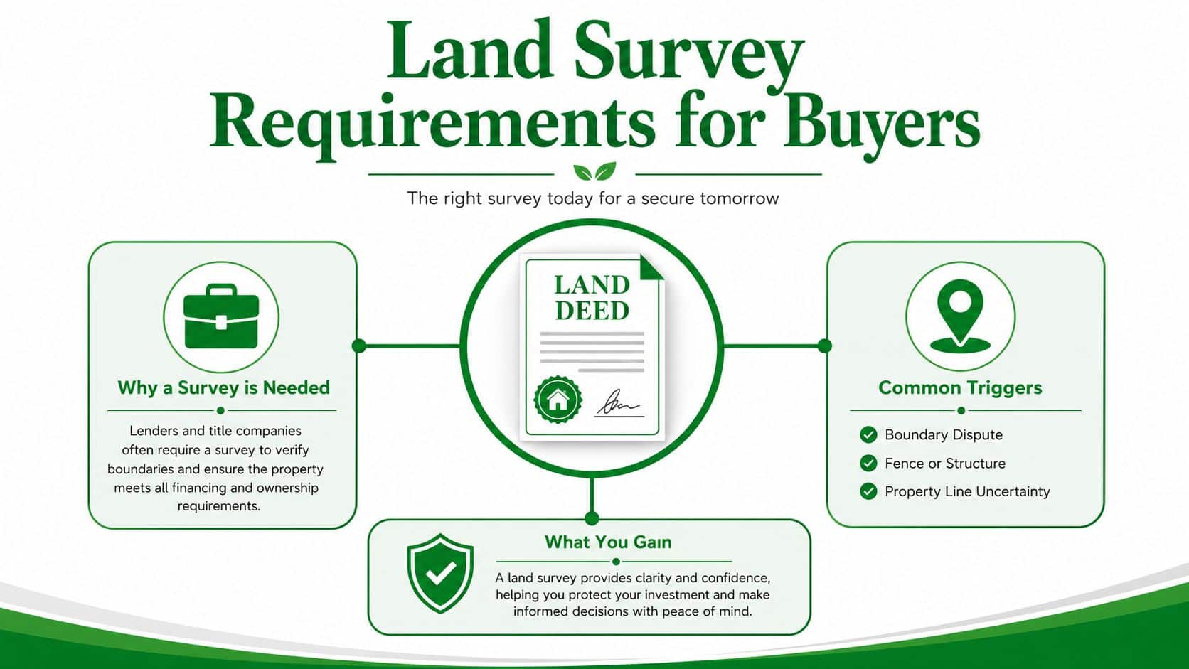
You're in escrow on a five-acre parcel in a state you've never lived in, and someone suddenly says you “need a survey.” That phrase sounds simple, but it's really shorthand for a decision about what problem the survey has to solve. A survey for closing doesn't have the same purpose as a survey for a fence line, a building permit, or title insurance.
The oldest mistake buyers make is treating land survey requirements like a universal checklist. They're not. The land is described through legal records, and in much of the country that framework traces back to the Public Land Survey System, created by the Land Ordinance of 1785 after the 1783 Treaty of Paris to divide and sell public land (PLSS background). That history still matters because the boundary you think you bought is the boundary the record can prove.
What the phrase really covers
For a buyer, "requirements" usually means three things at once: the legal purpose, the technical standard, and the deliverable. The legal purpose might be closing, title insurance, or building readiness. The technical standard tells the surveyor what framework to use. The deliverable is the thing you receive, such as a plat, monument set, or digital file.
Remote investors, off-grid buyers, and first-time buyers using owner financing feel this most. They often buy land without standing on it first, so the survey becomes the only hard evidence of what the parcel can support. If you're also sorting out zoning and land use, property zoning in the United States shapes what a survey needs to prove before you spend money on improvements.
Practical rule: buy the survey that supports your next action, not the fanciest one a seller can name.
The point is simple. If you know whether the parcel is headed toward closing, fencing, building, or title work, you can ask for the right survey the first time.
When You Actually Need a Survey and When You Don't
A survey is not mandatory just because you're buying land. It becomes necessary when a lender, title underwriter, county office, or your own plans need the boundary documented in a particular way. Miss that distinction and you'll either overspend or get stuck with a parcel you can't use the way you intended.
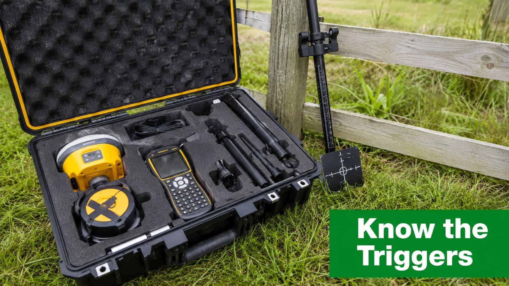
Five common triggers
- Lender or title insurance demand: The surveyor is being asked to confirm the boundary and show what could affect insurability or financing. If the deal needs that paper trail, you need a survey that satisfies the underwriter, not just your curiosity.
- Boundary dispute: Now the survey has to reconcile record evidence and physical evidence, because the issue is no longer academic. The buyer pays to find out where the legal line sits.
- Fence or structure placement: The surveyor is helping you avoid crossing the line before you pour concrete or set posts. That's a different job from a closing survey because the layout has to support construction decisions.
- Subdivision or access road: Here the survey supports a change in how the parcel is legally described or accessed. That often means more documentation and stricter technical control.
- Resale documentation: A clean survey can make future marketing easier, but only if it matches the parcel's current condition. Reusing an old one is risky if anything changed on the ground.
A buyer who only needs to close on raw land may get a boundary plat and legal description. A buyer adding a fence usually needs corner confidence and monument ties. A buyer preparing a building site may need boundary work plus additional site data tied to the proposed improvement. Different purpose, different product.
If the survey is mainly about parcel division or access planning, these subdivision steps show why the deliverable quickly becomes more than a simple sketch.
If the next step is legal transfer, get enough survey to clear title. If the next step is building, get enough survey to place improvements safely. If the next step is just watching the market, skip the expense for now.
That rule will save you money more often than any checklist.
The Records-First Workflow a Licensed Surveyor Runs
A competent boundary survey starts in the office, not in the field. The surveyor reads the deed, studies the parcel's recorded description, and pulls enough adjoining evidence to understand what the record claims before anyone drives a stake. That is the difference between a defensible survey and a map that looks neat but can't survive a dispute.
What gets reviewed first
The surveyor should gather the recorded description, adjoining deeds, plats, right-of-way records, easements, and any prior surveys that touch the parcel. Then comes the field search for monuments and other controlling evidence. That sequence matters because record evidence can override assumptions, and field evidence can expose old mistakes that were never cleaned up.
The Missouri rule in Cornell's legal text is blunt about the method, a defensible land-boundary survey starts with a records-first workflow, and the surveyor must base the work on the parcel's recorded description, gather enough title evidence before fieldwork, and search for monuments before setting or confirming corner monuments at every exterior corner (records-first workflow). That's the standard mindset you want, even if your state uses different wording.
A good survey is mostly research with boots on the ground at the end.
That matters to you because the quality of the record trail affects price and timing. A parcel with clean plats and obvious corners usually takes less effort than one with conflicting deeds, missing monuments, or old fence lines pretending to be boundaries. When record and physical evidence disagree, the surveyor has to reconcile them, and that's where surprises live.
The best question you can ask before hiring anyone is not “How fast can you get out there?” It's “What records will you review before you field the job, and what happens if the deed and the ground don't match?” A serious surveyor will answer that without fluff.
How State-Specific Standards Change the Deliverable
The same five-acre parcel can produce very different survey products depending on the jurisdiction. That's why generic advice fails. Some places lean on PLSS corner evidence and recorded descriptions, while others demand coordinate frameworks, monumentation rules, or precision standards that change what the final document must show.
| Jurisdiction | Datum/Framework | Corner Rule | Accuracy Standard |
|---|---|---|---|
| PLSS-based areas | PLSS legal description tied to section and aliquot references | Corners and monuments control the boundary where available | Varies by state and survey type |
| Maryland | State boundary survey standard | Corner evidence must support the plotted boundary | Maximum allowable relative positional precision of 0.07 feet (2 cm) plus 50 ppm (state-specific standards) |
| Other jurisdictional frameworks | Different datum or monumentation rules | May require specific corner set or re-established monuments | Different technical bar by parcel and use case |
Why this changes your paperwork
In a PLSS area, the survey may lean heavily on section lines, quarter sections, and recorded lot descriptions. In another state, the same parcel may need a more coordinate-driven product tied to a specific datum and control network. In practice, that can change whether you receive a boundary plat with monumentation notes, a coordinate-based survey, or a deliverable shaped around a development approval.
Saudi survey guidance, for example, requires connection to the National Geodetic Network, use of high-precision GNSS, total station, and leveling methods, and a contour-elevation accuracy standard tied to the contour interval and confidence level. Maldives submission rules are even more document-heavy, requiring a consolidated PDF report, a survey plan, spatial data in ESRI Shapefile format, and raw and intermediate instrument data. Those examples show the core point, technical standards now govern the deliverable as much as the field measurements themselves (survey technical guidance).
For you, the takeaway is blunt. Don't ask only whether a survey is required. Ask which standard governs the parcel and what the surveyor will hand over when they're done.
Choosing the Right Licensed Surveyor for Your Parcel
Hiring a surveyor is not a price-shopping exercise. You're hiring someone to create a legal record that may outlive your ownership, so the cheapest bid is often the least useful one. A better approach is to check whether the surveyor can produce a document a lender, title company, or county office will accept without a fight.
What to verify before you sign
- Active state licensure: Confirm the surveyor is licensed where the parcel sits, not just where their office is.
- Professional liability insurance: If they miss something, you want a professional who can stand behind the work.
- Local recorder familiarity: A surveyor who knows the county recording habits usually avoids format problems and rejections.
- Modern equipment: Ask whether they use GNSS, a total station, and drone tools when the site benefits from them.
- Sample deliverable: Request a recent plat or report so you can see whether the output is clear, sealed, and usable.
Ask direct questions on the estimate call. What standard will you work to? What exactly is included in the deliverable? Will you set monuments? Will I get a digital file? What happens if the deed and the field evidence conflict? Those questions separate a real professional from someone selling a quick site visit.
The labor market also tells you something about availability and lead times. The U.S. Bureau of Labor Statistics reports the median annual wage for surveyors was $72,740 in May 2024, with employment projected to grow 4% from 2024 to 2034 and about 3,900 openings per year on average over the decade (BLS surveyors outlook). That points to steady demand, which means good surveyors are busy for a reason.
Practical rule: pay for competence and documentation, not just a field truck and a flagging reel.
If you're buying once and planning to hold, that's the right tradeoff.
A Realistic Timeline and the Documents You Should Expect
On a rural vacant-land purchase, the survey process usually starts with records research, not a site visit. The first week is for pulling the deed, plats, adjoining records, and any prior surveys the surveyor can find. If the parcel sits where utilities or future access matter, that planning can overlap with your broader land development research, including bringing utilities to your land.
What the timeline often looks like
Week one is research and records assembly. Weeks two and three are fieldwork, depending on access, weather, and whether the corners are easy to find or buried in brush. Week four is drafting, internal review, and reconciliation between what the record says and what the field evidence showed. Final delivery usually follows after the plat is sealed and any recording step is finished.
What you should expect at the end depends on the parcel type. For a metes-and-bounds tract, the survey package often needs a stronger written description and tighter corner notes. For a recorded subdivision lot, the deliverable may be more compact, because the lot is already anchored to a recorded plat. Don't assume the same paperwork fits both.
Ask for these documents if they apply:
- Signed and sealed survey plat: This is the primary map you'll keep in your permanent file.
- Written legal description: Useful for title, closing, and future resale.
- Corner-monument affidavit or tie sheet: This shows where the corner was found or set.
- Easement or encroachment notes: These flag issues that affect use, access, or future improvements.
If the surveyor finds a discrepancy with the deed, expect that to be documented, not hidden. A good surveyor tells the truth in the plat. A bad one smooths over the problem and leaves it for the next owner.
The buyer's job is simple. Track progress, ask for drafts if needed, and make sure the final package matches the way you plan to use the land.
Final Checklist Before and After the Surveyor Leaves
Before you pay the final invoice, confirm that the survey answers the question you had. If you ordered it for closing, make sure the title company can use it. If you ordered it for fencing or a structure, make sure the corners are marked and the setback picture makes sense. If you ordered it for title insurance or resale, verify that the legal description and notes are clean enough to carry forward.
Keep the final package in your permanent file. You want the signed and sealed plat, the legal description, the corner ties, and any recorded easement or access notes. Those documents matter more than the field tape ever will, because they're what you'll hand to a lender, builder, attorney, or future buyer.
Red flags that mean you should order a new survey
- The parcel changed hands and the old survey predates the transfer.
- A fence, driveway, or structure was added after the earlier survey.
- The seller's copy is unsigned, unsealed, or missing corner notes.
- The county, lender, or title company asks for a different standard.
Three questions come up constantly. Do you need a survey to close? Often the answer depends on the lender, title underwriter, and deal structure, so don't assume no request means no need. Can the seller provide one? Sometimes, but only if it's current enough and matches your transaction. How long is a survey valid? There's no universal expiration date, because a survey can go stale as soon as the land changes or the transaction requires a different standard.
If you're browsing affordable parcels in Arizona, Colorado, Florida, or another state page, start by matching the land to your use case before you chase the lowest price. A survey that fits the parcel, the county, and the next step will save you from expensive cleanup later.
If you want a simpler way to compare parcels before you buy, LandZero gives first-time buyers a place to browse affordable land by state and budget while keeping the financing process straightforward. Use it to shortlist parcels, then order the right survey for your actual goal, not the one somebody else guesses you need.